Arto's Blog
| « Seaside villages, huge leaves and roadworks on the Carretera Austral | Hot springs and strawberries for Christmas » |
Camping up in the mountains between border controls
Posted: 2015-01-17 05:47:00, Categories: Travel, Cycling, Hiking, Chile, Argentina, 592 words (permalink)
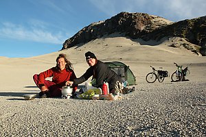 Our most spectacular campsite on this trip so far was near the Antonio
Samore mountain pass, right on the Argentinian-Chilean border. We set
up our tent on the plateau facing the Puyehue volcano with a panoramic
view of other volcanoes and mountains in every direction. The sunset
coloured the sky first orange and red, later violet, followed by a
clear full moon night.
In Argentina we cycled the classic "seven lakes" route from San Martin de Los Andes until Villa la Angostura. It was a pretty road, but the weather was cloudy and rainy so we didn't spend much time at the lakes. In Villa la Angostura we stayed in a hostel and celebrated New Year with other travellers, mostly Argentinians on their holidays. On New Year's day we already headed back towards Chile.
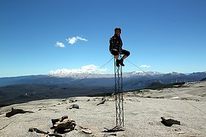 We camped one day at a river still on Argentinian side, and reached
the border at the top of the Antonio Samore pass on the second day.
The Argentinian customs and passport control had been already 20 km
before and the Chilean ones were 20 km further ahead. It seems to be
pretty common here that the border area is dozens of kilometers wide,
and it's not a problem to spend even several days between the control
points.
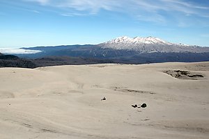 Only a few hundred meters after the pass on the right hand side was
a small jeep track leading up towards the nearby peaks. We followed
that and were soon like in a different world: sand everywhere, small
streams in deep canyons and a view towards all directions. We could
see the Puyuhue and Casablanca volcanoes, various other mountains and
also Puntiagido and Osorno volcanoes further away.
After about a kilometer we left most of our bags on the side of the track and continued further up with a lighter load. Then we left the bikes behind as well and climbed on top of the nearest peak. In the loose sand we got our shoes full of sand and small stones, but otherwise it was quite easy to climb. On the top we had a picnic and enjoyed the sunny afternoon.
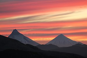 We descended on the north side and were directly on the border,
indicated by an old metal sign saying "Chile" on one side and
"Argentina" on the other. The track ended there but some footsteps
were going forwards. We followed them and climbed still the next,
slightly higher peak before coming back and picking up our stuff.
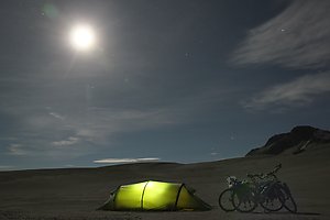 It was surprisingly windstill so we chose to set up the tent
directly on the open plateau at 1500 meters of altitude. It was a rare
place, with so much sand around and looking very dry, but still having
water available in several small streams. We cooked dinner and
prepared tea while admiring the sunset. Then we had a rest in the
tent, but came later out for a while to watch the moon and the stars
before going to bed. The temperature dropped below zero during the
night, but our sleeping bags were warm enough to sleep comfortably.
In the morning we had breakfast, packed our things, cycled back to the main road and further down to the valley towards Entre Lagos and Osorno. On the good paved road it was a fast ride through a quite strange landscape of dead trees. Later a park ranger explained us that it was a result of an eruption at one of the Puyuhue volcano side craters just a few years ago. The grey scenery lasted for about 10 kilometers, down in the valley everything was green again.
1 comment

Copyright Arto Teräs <ajt@iki.fi>, licensed under the Creative Commons Attribution-Share Alike 3.0 Unported License. (Unless otherwise mentioned in individual photos or other content.)