Arto's Blog
| « Like a painted scenery | Camping up in the mountains between border controls » |
Seaside villages, huge leaves and roadworks on the Carretera Austral
Posted: 2015-01-31 22:48:00, Categories: Travel, Cycling, Hiking, Chile, 851 words (permalink)
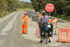 We spent 2,5 weeks in January cycling from Puerto Montt to
Coyhaique on the road number 7, better known as the Carretera
Austral. It is the main and only road leading south in this part of
Chile. Most of the villages and towns on the way are small so the
traffic wasn't heavy, and the road surface was in many parts still
gravel. However, as the only land route south it is becoming
increasingly important, and there is a big effort going on to make it
paved at least for the complete northern half until Coyhaique.
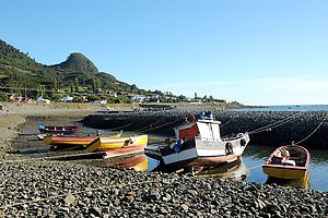 The first 60 km from Puerto Montt the road followed the seaside, a
relatively narrow passage between the island of Chiloe and the
mainland. The coast was lined with small fishing villages which looked
pretty in the late afternoon and evening sun. We camped on a small
grass field facing the sea and could see the sun setting behind
Chiloe.
 The next day we left the sea for a while and hit the first section of
roadworks: 20 km of bad gravel, dust, trucks and other machines
preparing the road for pavement, which unfortunately wasn't ready
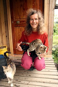
yet. The day was saved by a very nice guesthouse where we stayed with
eleven cats, other animals including dogs, ducks and goats, and a nice
family taking care of all of them and us as guests of course. We even
got homemade bread and duck eggs to complement our dinner which we
cooked ourselves in the kitchen.
 From Hornopiren there was a 5 hour passage by two ferries until Caleta
Gonzalo, where we entered the Pumalin Nature Park. It is private land
but maintained in a similar way than national parks, with marked
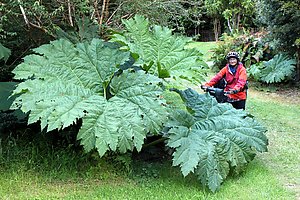
hiking trails, campsites and information services. The park was full
with lush vegetation, in particular large ferns and huge wild rhubarb
leaves (nalca in spanish), some of them more than two meters across.
It was clearly a region with lots of rain and we also had our share,
but luckily also a few sunny moments between the clouds. The campsites
were beautifully arranged and the same aesthetic appearance was
carried out throughout the park, including every sign and information
board. Unlike national parks, there were no entrance fees to access
the trails, and the campsites were very modestly priced at 2500 CLP
(about 3,5) per person.
 From Pumalin we came to Chaiten, where we stayed one night in a
guesthouse and refilled our food reserves in a supermarket. After
Chaiten the road was paved, relatively flat and we even had a good
tailwind for the next 40 km so it was easy cycling for a while. Then
it was gravel again, but a fairly pleasant and smooth one this time.
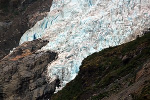
At Ventisquero Yelcho there was a free camping and a walking trail
leading to a glacier hanging down from the mountains.
 We started meeting more and more cyclists on the way, most of them
travelling south as we did. The majority were Chileans, but there were
many from other parts of the world as well. One of them, Alex from
Australia, joined us for a few days. Together we did a very nice
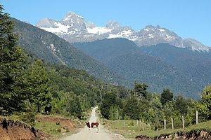
detour in a small quiet valley leading to lake Claro Solar. With the
mountains in the background and a couple of farms with cows on the
fields it looked a lot like German or Austrian Alps.
 We passed the town La Junta and about 40 km later stopped in another
called Puyuhuapi, where we stayed mostly inside because of the rain
and had a rest day. The Internet was good enough to
call our families, catch up a bit on what's happening in the world
(which we rarely do on the road) and search for information about the
areas coming up. In the night there were fireworks and a dance party
to celebrate the foundation of the town about 80 years ago.
 After Puyuhuapi we came to the Queulat National Park, where we saw
another glacier and had a relaxed evening with our own small campfire at
the park campground. The next day we cycled further and walked the
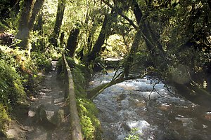
"Bosque encantada" (enchanted forest) trail through a
beautiful moss-covered old forest until a laguna up in the mountains.
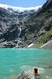 About 20 other people had also found their way there —
surprisingly many considering that the beginning of the trail was
poorly marked, and it wasn't one of the shortest nor easiest walks
either.
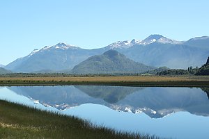
The last 180 km until Coyhaique the road was paved and not too
hilly, following river valleys between the mountains. It was sunny
again and one of the days was so hot that we had a long afternoon
break cooking in the shade and swimming in the Maniguales river.
 Traffic became heavier as we approached the city and the road was
narrow so it was probably one of the most dangerous sections of the
whole trip. Still, almost all the passing cars left us plenty of space
and we arrived safely to Coyhaique. That was a perfect place to have a
break, take a nice warm shower, get our clothes washed, communicate
with our WarmShowers hosts and prepare for the way further south.
1 comment

Copyright Arto Teräs <ajt@iki.fi>, licensed under the Creative Commons Attribution-Share Alike 3.0 Unported License. (Unless otherwise mentioned in individual photos or other content.)