Arto's Blog
The end of the Antarctic summer
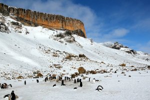
Posted: 2015-08-03 00:41:00, Categories: Travel, Argentina, Antarctica, Sailing, 673 words (permalink)We would have loved to stay longer, but the sunny landing at Brown Bluff was a wonderful goodbye to Antarctica. After lunch we raised the anchor and started first motoring and then sailing north-east towards South Georgia, a subantarctic island about 800 nautical miles away.
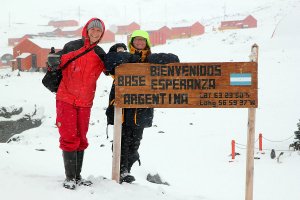
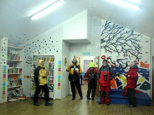
An Argentinian village on the Antarctic Peninsula
Posted: 2015-07-24 23:36:00, Categories: Travel, Argentina, Antarctica, Sailing, 638 words (permalink)First time on open sea
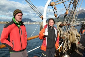
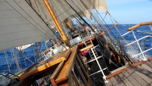
Posted: 2015-07-09 22:34:00, Categories: Travel, Chile, Argentina, Antarctica, Sailing, 875 words (permalink)We sailed out from Ushuaia in the morning of February 28th in beautiful, sunny weather. It was surprisingly windstill, especially in the morning. Later during the day a light breeze came from the west, the captain turned the engine off and we were moving quietly like sailing ships are designed to do, with just the wind pushing us forwards. We were on the Bark Europa, a hundred year old tall ship which sails to interesting destinations around the world.
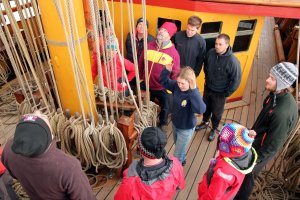
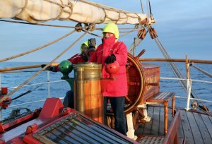
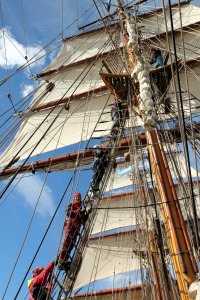
Almost right away after departure started the first training sessions, to make us voyage crew instead of just passengers. One of our duties was to take turns at the lookout on the front deck, watching the sea in front and reporting small boats, icebergs or any other obstacles the ship might risk hitting. We learned how to steer the ship to a compass direction given by the captain and how to handle ropes when setting up or taking down sails. We even put on harnesses and climbed up to the mast, learning where to attach the safety line when working up there.
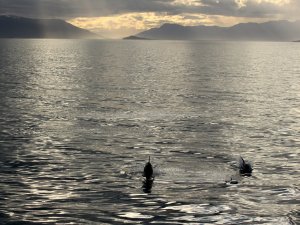
During the whole day and afternoon we stayed in the Beagle Channel, a relatively narrow passage leading out from Ushuaia to the Atlantic. Mostly we saw cliffs and mountains but there were also the town of Puerto Williams and a few smaller settlements on the south side. Many different birds, mainly albatrosses and petrels, were flying around the ship and in the evening a group of dolphins came to greet us. It was a pleasure to watch them dive under the ship and jump in the air on both sides very close to us.
Little by little the canal became wider, at the mouth of it were a few islands and then we were out in the open sea. It was the beginning of the Drake Passage between the southern tip of Chile and South Shetland islands, which are located a couple of hundred kilometers north of the Antarctic mainland. For Sandra and me it was the first time on a real ocean passage, with no land to see for several days.
The wind was relatively light but there was a continuous flow of relatively large waves, or swell as it is called, coming from the west. The waves were not sharp so they didn't strongly hit the sides or splash any water overboard, but made the ship rock back and forth, and roll from side to side. The wind itself came from a different direction, which made the movements seemingly random. There was no easy way of seeing in which direction and how deep the ship will bow at any given time, even when being outside and watching the waves. Inside it was of course still worse and within a few hours we both felt the first signs of seasickness.
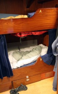
During the following three days we struggled with being seasick, trying to still take part in the activities as much as we could. We took medication which helped a bit, but more important was to pay attention on what to do and not to do. Easiest was to lay in bed, as there the body doesn't try to be in control of the movements. Second best was to be outside and look at the waves or the horizon, and to sit in the deckhouse with large windows was mostly okay. Worst was to read a book or to do anything else which required looking down. The most difficult activities which we couldn't avoid were getting dressed in the cabin and using the bathroom. Nevertheless, we survived and even managed to attend to almost all the interesting lectures about wildlife and practical exercises about handling the sails, led by the permanent crew of the ship.
On the second and third day the wind picked up in speed and turned so that it was coming from more or less the same direction than the swell. It was still relatively light for the infamous Drake passage but a strong good wind for sailing. The waves became higher and water was running from side to side over the main deck. That was normal and nothing to fear about, the ship was taking the waves beautifully and felt secure. And although it was at times more tilted sideways than on the first day, the movements were more predictable. In short, it was behaving like a good sailing ship should. We still had an uneasy feeling in our stomachs but were slowly getting used to it.
On the fourth day of crossing the Drake passage the wind first turned to come from the south and later calmed down. The crew took down the sails with the help of us, the voyage crew (that's how the paying guests are called on Bark Europa) and the captain started the engine first time since Beagle Canal, if not counting the man overboard drill on the previous day. Not long afterwards we saw the first iceberg, a huge block of ice rising to a height of about 100 meters above the surface, and nobody knows how deep below it. Only a few miles further south were the first rocks belonging to the South Shetland islands, our first destination.
Good bye bicycles, we'll go sailing!
Posted: 2015-02-27 19:31:00, Categories: Travel, Hospitality exchange, Hitchhiking, Chile, Argentina, 715 words (permalink)
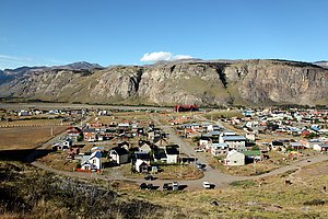 In El Chalten, Argentina we stayed at a kind of cyclists' camp.
It was a small house at the edge of the town belonging to Florencia, a
local woman who welcomed all touring cyclists to camp in her garden
against a voluntary donation to cover electricity, gas and water
costs. As it was high season, the place was packed with guests.
Sharing one bathroom with more than twenty others required some
patience, but it was a great place to meet other cyclists on shorter
and longer tours, most travelling south but some north as well.
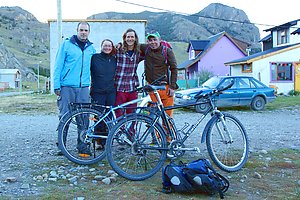 Our time was slowly running out so we asked Florencia if she'd know
someone who would be interested in buying our bicycles. It didn't take
long before a friend of her appeared and was interested in mine. We
said that we'd like to sell both at the same time, the word passed
around and soon came another man who was looking for a bike for his girlfriend. We
asked for a reasonable price and both bikes were sold. Next day,
before the new owners came to pay and collect the bikes, we would have
even had a second buyer for both. We learned that it is difficult in
Argentina to get quality bikes and the prices are higher than in
Europe. There was more interest than we had expected and we ended up
even selling two of our panniers and one of the front bags. A big
change in our trip and faster than we had thought! However, we had
known that we would have to get rid of the bikes sooner or later and
had bought them second hand specially for this tour. After selling
them, we felt slighly sad but relieved that there was one thing less
to think about.
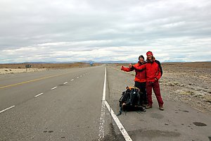 Our next goal was to arrive in Ushuaia, the southernmost city in
Argentina about 1000 kilometers further south mostly through the treeless
pampa. In between we had to still pick up a package containing some
winter clothes from Puerto Natales in Chile. It would have been
possible to travel by bus, but we had still over a week of time and
decided to try hitchhiking. When travelling on the Carretera Austral,
we had often seen hitchhikers by the roadside and without bicycles it
was now easier for us too.
The way of the thumb worked well. Every time nice people picked us up, we got to practise our Spanish and enjoyed a lot of mate tea as almost in every car the traditional cup of mate was passing around between the passengers. We made our way to Puerto Natales in one day, probably faster than it would have been by bus. There we stayed a couple of days with a CouchSurfing family before continuing forwards. To get out of Puerto Natales was a bit more difficult, but after a couple of hours waiting and walking we got a ride near Punta Arenas, where we camped by the seaside. Next day, the first car picked us up and we only had to change once for a ride directly to Ushuaia. Not only did we get there in time but had also local contacts in the city to spend some time with, perfect. Through a recommendation of another traveller we met in Puerto Natales, we also found a very friendly family from which we rented a room for our last few days in Argentina.
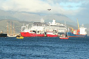 Soon after posting this, our next big adventure will begin. Tonight we
will board the sailing ship Bark Europa for a 52 day sailing journey
to Antarctica, South Georgia, Tristan da Cunha and South Africa.
During that time we won't be able to post anything in the blog nor
read our emails, and naturally our mobile phones won't work either on
the seas. For me, it'll be the longest time without Internet since I
started using it 20 years ago. Probably hard, but I'm sure I will
survive. :-) It is however possible to follow the progress of the
journey via Internet on the Bark
Europa homepage. The position of the ship will be regularly updated on the world
map and occasionally also logbook entries will be transmitted on the
site via a satellite connection. We will write next time in about two
months after we've arrived in South Africa.
Road through the wilderness
Posted: 2015-02-27 19:15:00, Categories: Travel, Cycling, Chile, Argentina, 1258 words (permalink)
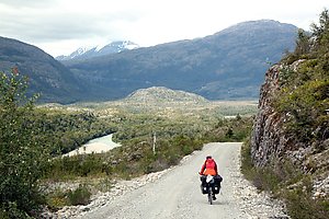 After our hiking trip in National Reserve Cerro Castillo we continued
cycling south on the Carretera Austral. There were no cities or major
towns any more and even villages were further and further apart from
each other. Especially the last 200 km stretch from Cochrane until
Villa O'Higgins was a small road through the wilderness, with few
houses and plenty of moors between the mountains, rivers and forests.
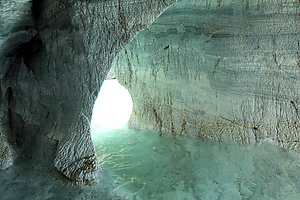 After Villa Cerro Castillo the pavement ended and the road headed
directly west for quite a while before turning south again. The next
slightly bigger settlement was Puerto Rio Tranquilo, a touristy town
famous for its marble cliffs and caves. Like most visitors, we took
a boat tour to see them. The boat spent more than half an hour near
the rock formations and went inside several of the caves, so we were
quite satisfied with the tour. The way back was like a roller
coaster ride, the small boat jumping up and down the waves on
the windy lake.
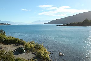 The road followed the coast of the lake General Carrera, at times
high on top of the cliffs offering marvellous views of the lake. At
the bridge over the narrow passage between lake General Carrera and
lake Bertrand we stopped for a break. A Chilean family was enjoying
the sunny afternoon and the father started fishing using a simple
reel of line, a hook and baits. Within twenty minutes he had caught three
trouts, one weighing a bit less than a kilo and two smaller ones,
one of which he gave to us to cook for dinner.
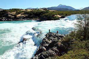 Following day we arrived to the southern end of lake Bertrand, where the
water was flowing out forming the beginning of the Baker river. It
was one of the most beautiful rivers on our route, with clear
blue water rushing down the valley. Some 15 kilometers
further south was the confluence of rivers Baker and Nef, where
large masses of water joined each other with great force. The water
from Nef was much more brown so Baker lost its superb colour at
that point.
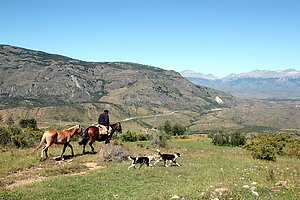 Before arriving to Cochrane, we took an alternative route on the
other side of the Baker river. In distance it was probably even a
bit shorter than the main road, but included a very steep climb of
500 meters of altitude over a pass. We had to push our bikes several times,
but enjoyed the views and the quietness of the route — during
the whole 30 km we saw only one car and a horseman.
Cochrane was a slightly larger town than all others in the region with a couple of thousand inhabitants and a better than average selection of groceries. We bought food for a week knowing that there wouldn't be any shops during the next 230 kilometers, and headed out to the last section towards Villa O'Higgins, the southernmost point of the Carretera Austral.
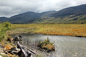 The first 40 kilometers after Cochrane was very bad gravel with a
lot of washboard, not the most enjoyable cycling experience. There
was also still a significant amount of traffic, mostly cars and
minivans heading to Caleta Tortel, a village famous of its wooden
walkways by the sea. We were not willing to cycle 25 km there and
the same way back to see the village so we skipped it and continued
directly south from the Tortel crossing.
After the crossing of Caleta Tortel the number of cars reduced dramatically and the road became nicer and nicer. Water was flowing down from the mountains on both sides of the road in numerous small streams. There were many lakes and even more wetland, making us feel like being in Swedish or Norwegian Lapland. It was the only road through wilderness with only an occasional house every 10 or 20 kilometers, which contributed to the Lapland feeling. Although even here fences often separated the privately owned lands from the public road, there were plenty of wonderful places for wild camping.
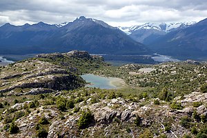 We came forwards a bit faster than we had anticipated and arrived in
4,5 days to Villa O'Higgins. It was a rather pleasant village or
small town, mostly living from the tourism but featuring modest
family-owned guesthouses and small grocery stores instead of hotels
and fancy restaurants. It was a dead end for everybody coming by a
motor vehicle, which meant that most didn't bother to drive that
far. There was a general sense of calmness and we heard of many people
who had stayed in the village longer than they had originally
planned. We spent three days resting and going for a couple of short
walks, and would have probably stayed for some days more if we
didn't have a certain date to be in Ushuaia, still quite a long way
further south.
For cyclists and backpackers, it was possible to continue further from Villa O'Higgins and to cross the border to Argentina. Actually there were even two alternatives, a road and hike over the mountains to the east and a more well known ferry crossing plus hike towards the south. We chose the latter, mainly because it brought us much more directly towards Puerto Natales, where we had sent a package at the beginning of our trip to pick up later.
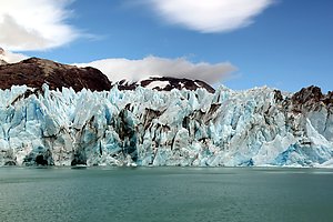 One of the two ships crossing the lake O'Higgins offers a half day
side trip until the glacier carrying the same name. Compared to the
steep fare of simply getting on the other side of the lake, the
glacier tour was more reasonably priced so we decided to go for the
full package. The tour brought us close to the impressive wall of
ice several dozen meters high, with small icebergs breaking off and
floating on the lake. We had never been so close to a big
glacier before and with its various shades of blue it was more
colourful than other glaciers we had seen on the trip. As a small
surprise a glass of whisky with glacier ice was served to all
passengers. We opted for the kids' version of juice and ice,
adding alcohol to our already slightly upset stomachs after the
trip on the windy lake didn't feel like a good idea.
 The majority of passengers returned on the ship to Villa O'Higgins,
we and a few others stepped out on the south side of the lake, where
we camped for a night before continuing. The Chilean border control
was only a few hundred meters further, the actual border with
Argentina 15 kilometers away. Until that point there was a narrow
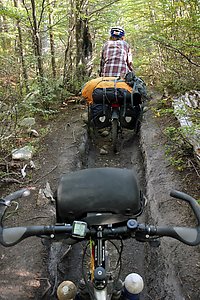
gravel road, followed by a 6 km hiking trail leading to the Argentinian
border post at Lago Desierto. It was a scenic but pretty strenous
day, as our loaded bicycles were not the ideal vehicles for a narrow
trail going over roots and stones. However, we got through with lots
of time and patience, as all the other cyclists taking the same
route.
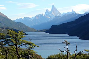 Lake Desierto was a beautiful place for a rest day. It was free to
camp at the northern shore and during the first evening we had a
great view to the Fitz Roy mountain and other high peaks over the
lake. One day later we took another expensive ferry over to the
southern shore to avoid another longer stretch on a hiking trail
around the lake. Then it was only a 40 km easy ride to El Chalten, a
touristy town and a hub of hiking trails near and around the famous
mountains and glaciers. For us, it was the ending point of our
bicycle tour, and the beginning of a new chapter in our travels.

Copyright Arto Teräs <ajt@iki.fi>, licensed under the Creative Commons Attribution-Share Alike 3.0 Unported License. (Unless otherwise mentioned in individual photos or other content.)
