Arto's Blog
| « Hot springs and strawberries for Christmas | Cycling and camping in Chilean summer » |
Volcanic scenery in Malalcahuello and Conguillio
Posted: 2014-12-29 16:06:00, Categories: Travel, Cycling, Hiking, Chile, 823 words (permalink)
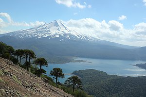 We spent 1,5 weeks exploring the Malalcahuello National Reserve and
the Conguillio National Park, both on foot and by bicycle. Both parks
were dominated by volcanoes and their past activity, including several
eruptions during the last 100 years. The contrast between almost black
volcanic sand and lush green forests was dramatic. There were a lot of
magnificent hundreds of years old trees, with thick layers of
lichen growing on the trunks and hanging from the branches.
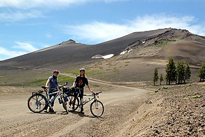 We started by cycling from Victoria to Curacautin and further to
Malalcahuello where we stayed with Claudia from CouchSurfing. She had
a beautiful house a few km outside the village, so deep in a valley
between the mountains that we didn't even have mobile phone
reception there. It was a good place for relaxing and an excellent
base for tours in the region.
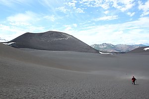 On one day we cycled up along the road leading to a ski center at the
Lonquimay volcano, the highest peak of the area. There was still quite
a bit of snow covering the higher parts of the volcano, but not enough
for skiing so it was off-season and quiet. From the ski center started
a still smaller road, marked as being for 4x4 vehicles only but it was
also suitable for bicycles.
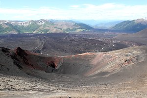 The road led us across dark volcanic sand to a sign which marked
the start of a walking trail to Crater Navidad, the crater of the last
eruption of the volcano on Christmas day 1988. After a 1,5 hour walk
through the dusty sand field and a slope of loose stones we stood at
the edge of the crater, at 1891 meters of altitude. It was almost 1000
meters lower than the main volcano but had a panoramic view over the
lava flow and the surrounding area. The rocks at the crater had
many different colours, a lot of varioud shades of red, some white,
brown and yellow in addition to the dominatic nearly black rocks.
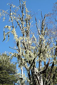 On another day we walked the Piedra Santa trail which started down in
the village and went through a forest on top of a hill. There were a
lot of old trees with lichen hanging from every small
branch, creating a quite special atmosphere. In higher altitudes,
other tree types gave way to the Araucarias, our favourite tree
because of their beautiful shapes against the blue sky. Because of the
approaching holidays we called them the Christmas trees of Chile. We
also saw a pair of condors cruising in the air. Otherwise there were
surprisinly few birds to see or hear, we thought that in such an old
forest we'd be hearing birds singing almost all the time.
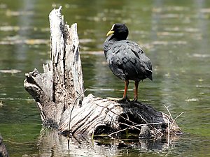 From Malalcahuello we returned to Curacautin and continued south
through the Conguillio National Park. It had also black volcanic
scenery like the Malalcahuello Reserve, but more lakes and also
non-volcanic peaks of more than 2000 meters. The main road through the park was a narrow
gravel and earth road, allowed for all kinds of vehicles but some
parts would have been fairly difficult to manage with a normal car. No
wonder that the most common vehicles in the Chilean countryside are
4-wheel-drive pickups, jeeps and SUVs. There it at least makes sense
to have one, unlike in most places in Europe and North America where
even minor roads are so good that a normal car is not only more fuel
efficient but also better to drive.
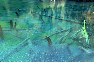 The highlights of Conguillio were the lakes, each of which had a
different character. Laguna Captrén had sunken trees sticking
out of the water and several bays with more bird life than we saw in
other areas of the park. The Conguillio lake was the biggest lake with
a panoramic view of the mountain range behind it, and an interesting
mix of volcanic rocks and plants on the shore. But perhaps the most
beautiful was the tiny Laguna Arco Iris, which was surrounded from one
side by a lava field and from the other side by forest, and had
wonderful colours in the water when looking down from the shore.
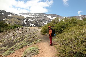 We also did a one day hike on the Sierra Nevada trail, which went up
from the Conguillio lake to the non-volcanic peaks. We didn't climb
until the top but above treeline and had very varying scenery on the
way. From a distance the mountains looked a lot like the Alps in
Europe, but both the trees and other vegetation were quite
different.
Overall, we were surprised how few people we met on the trails. They were easy to walk and well marked, but it seemed that most of the visitors just drove through the park by car, perhaps stopping at a couple of sightseeing spots. We think that by doing so we'd be missing a lot — even by going slowly on a bicycle it's not possible to reach areas away from the roads and see the nature in the same detail than on the walking trails.
1 comment

Copyright Arto Teräs <ajt@iki.fi>, licensed under the Creative Commons Attribution-Share Alike 3.0 Unported License. (Unless otherwise mentioned in individual photos or other content.)